
Moscow Ring Road
You can help expand this article with text translated from the corresponding article in Russian. (December 2023) Click [show] for important translation instructions.
|
| Moscow Ring Road (MKAD) Московская кольцевая автомобильная дорога  | |
|---|---|
 | |
 MKAD on Moscow map | |
| Route information | |
| Part of | |
| Length | 108.9 km (67.7 mi) |
| Existed | 1961–present |
| Location | |
| Country | Russia |
| Major cities | Moscow |
| Highway system | |
The Moscow Automobile Ring Road (Russian: Московская кольцевая автомобильная дорога, romanized: Moskovskaya koltsevaya avtomobilnaya doroga), or MKAD (Russian: МКАД), is a ring road running predominantly on the city border of Moscow, with a length of 108.9 km (67.7 mi) and 35 exits (including ten interchanges). Completed in 1962, the road has a speed limit of 100 km/h.
History
[edit]The growth of traffic in and around Moscow in the 1950s made city planners realise that Russia's largest metropolis needed a bypass to reroute incoming traffic from major roads that run through the city. Construction started in 1956.[1] Opened in 1962,[2] the MKAD had four asphalt lanes and ran 108.9 kilometres along the city's borders. Although not then a freeway, it featured interchanges at major junctions, very few traffic lights, and a speed limit of 100 km/h (62 mph).
From 1960 to 1984 the MKAD ran around the administrative boundary of Moscow, but in the 1980s the city began annexing territory outside the beltway. In December 2002, Bulvar Dmitriya Donskogo became the first Moscow Metro station to open beyond the limits of the MKAD.[3]
The road was widened from four lanes to ten between 1995 and 1999; all intersections became grade-separated, pedestrian bridges were built, traffic lights were removed, and a solid concrete barrier was installed in the median. In 2001, slow-moving vehicles were banned from entering the MKAD, and the renovated road received a freeway designation from the mayor's office.
Route
[edit]This article contains a bulleted list or table of intersections which should be presented in a properly formatted junction table. (November 2021) |
| Distance (approx.) |
Destinations | Notes | |
|---|---|---|---|
| 0 km | |||
| 2 km | Pobeda ulitsa — Reutov, Ivanovskoe | ||
| 4 km | Ketcherskaya ulitsa, Nosovikhinskoye ulitsa — Balashikha, Elektrougli | ||
| 6 km | Novokosino District | ||
| 7 km | Moldagulovoy ulitsa, Novoukhtomskoe shosse | ||
| 8 km | North-Eastern Chord, Kosinskoe Highway | ||
| 8 km | Ryazansky prospekt, Lermontovsky prospekt — Lyubertsy | ||
| 11 km | |||
| 14 km | Verkhniye Polya ulitsa — Kotelniki | ||
| 16 km | Energetikov ulitsa, Kapotnya ulitsa — Dzerzhinsky, Kapotnya | ||
| 20 km | Besedinskoe shosse — Besedy | ||
| 24 km | Kashirskoye Highway | ||
| 27 km | |||
| 30 km | Bulatnikovo | ||
| 33 km | |||
| 35 km | Polyany ulitsa — Butovo | ||
| 38 km | Paustovskogo ulitsa — Yasenevo | ||
| 41 km | |||
| 45 km | |||
| 48 km | Borovskoye shosse, Ozyornaya ulitsa | ||
| 55 km | |||
| 56 km | Gorbunova ulitsa — Nemchinovka | ||
| 60 km | |||
| 61 km | Rublevo-Uspenskoye shosse — Rublevo | ||
| 63 km | |||
| 65 km | Myankininsky prospekt — Myakinino | ||
| 68 km | |||
| 72 km | Novokurkinskoye shosse — Kurkino | ||
| 74 km | Svobody ulitsa, Molodezhnaya ulitsa — Kurkino | ||
| 75 km | |||
| 78 km | |||
| 82 km | |||
| 85 km | Altufyevskoye shosse — Veshki | ||
| 91 km | Ostashskovskaya ulitsa | ||
| 95 km | |||
| 103 km | Khabarovskaya ulitsa — Abramtsevo | ||
| 105 km |
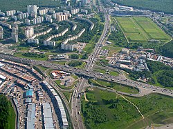
Gallery
[edit]-
 Interchange with Kashirskoye Highway
 -
 Interchange with Moscow–Saint Petersburg motorway
 -
 Interchange with Leningradskoye Highway
 -
 Interchange with Borovskoe shosse
 -
 Interchange with Mozhayskoe shosse
 -
 Interchange with Novorizhskoe shosse
 -
 Interchange with Volokolamskoe shosse
 -
 Interchange with Yaroslavskoe shosse
 -
 Interchange with Myakininsky proezd
 -
 Interchange with Molodogvardeyskaya street
 -
 Interchange with Dmitrovskoe highway
 -
 Interchange with Verkhniye polya street
 -
 Interchange with M2
 -
 MKAD near Strogino District
 -
 Interchange with Profsoyuznaya street/A-101 (Kaluzhskoe shosse)
 -
 Yaroslavskoe highway interchange
 -
 Interchange with Volgogradsky Prospekt in Moscow


.jpg)


See also
[edit]Ring roads in Moscow:
Notes and references
[edit]- ^
Harris, Adrienne M. (15 April 2019). "Moscow". In Orum, Anthony M. (ed.). The Wiley-Blackwell Encyclopedia of Urban and Regional Studies. Wiley Blackwell Encyclopedias in Social Sciences. Vol. 3. John Wiley & Sons. p. 1270. ISBN 9781118568453. Retrieved 11 April 2026.
[...] in 1956 [...] construction began on MKAD (МКАД), the Moscow Automobile Ring Highway [...].
- ^
Road Abstracts. Vol. 30. 1966. p. 50 https://books.google.com/books?id=IrJBAQAAIAAJ. Retrieved 1 April 2026.
[...] the outer Moscow ring road, which was opened to traffic in November, 1962 [...].
{{cite magazine}}: Missing or empty|title=(help) - ^ "Bul'var Dmitriya Donskogo". Moscow Metro official site. Archived from the original on 13 March 2012. Retrieved 30 June 2013.