
Lockport Heights, Louisiana
Lockport Heights, Louisiana | |
|---|---|
 Lockport Heights  Lockport Heights | |
| Coordinates: 29°39′02″N 90°32′47″W / 29.65056°N 90.54639°W | |
| Country | United States |
| State | Louisiana |
| Parish | Lafourche |
| Area | |
• Total | 1.32 sq mi (3.42 km2) |
| • Land | 1.31 sq mi (3.38 km2) |
| • Water | 0.015 sq mi (0.04 km2) |
| Elevation | 3 ft (0.91 m) |
| Population (2020) | |
• Total | 1,171 |
| • Density | 896.0/sq mi (345.96/km2) |
| Time zone | UTC-6 (Central (CST)) |
| • Summer (DST) | UTC-5 (CDT) |
| Area code | 985 |
| GNIS feature ID | 543408[2] |
Lockport Heights is an unincorporated community and census-designated place in Lafourche Parish, Louisiana, United States. As of the 2020 census, Lockport Heights had a population of 1,171.[3] Louisiana Highway 1 passes through the community.
Geography
[edit]According to the U.S. Census Bureau, the community has an area of 1.339 square miles (3.47 km2); 1.309 square miles (3.39 km2) of its area is land, and 0.030 square miles (0.078 km2) is water.[4]
Demographics
[edit]| Census | Pop. | Note | %± |
|---|---|---|---|
| 2010 | 1,286 | — | |
| 2020 | 1,171 | −8.9% | |
| U.S. Decennial Census[5] | |||
Lockport Heights was first listed as a census designated place in the 2010 U.S. census.[6]
Education
[edit]It is within Lafourche Parish Public Schools.[7] Zoned schools include:[8]
- Lockport Lower Elementary School in Lockport
- Lockport Upper Elementary School in Lockport
- Lockport Middle School in Lockport
- Central Lafourche High School in Mathews
References
[edit]- ^ "2020 U.S. Gazetteer Files". United States Census Bureau. Retrieved March 20, 2022.
- ^ "Lockport Heights". Geographic Names Information System. United States Geological Survey, United States Department of the Interior.
- ^ "2020 Decennial Census Redistricting Data (Public Law 94-171)". United States Census Bureau. 2021. Retrieved March 11, 2026.
- ^ "2010 Census Gazetteer Files - Places: Louisiana". U.S. Census Bureau. Retrieved January 16, 2017.
- ^ "Census of Population and Housing". Census.gov. Retrieved June 4, 2016.
- ^ "2010 Census of Population - Population and Housing Unit Counts - Louisiana" (PDF). United States Census Bureau. Archived from the original (PDF) on April 2, 2024.
- ^ "2010 CENSUS - CENSUS BLOCK MAP: Lockport Heights CDP, LA" (PDF). U.S. Census Bureau. Retrieved May 20, 2021.
- ^ "SCHOOL ATTENDANCE BOUNDARIES Archived 2016-12-02 at the Wayback Machine." Lafourche Parish Public Schools. Retrieved on December 2, 2016. Based on the text description of the school boundaries: "Highway 1 - area from 4901 Highway 1 to 9429 Highway 1"
Municipalities and communities of Lafourche Parish, Louisiana, United States | ||
|---|---|---|
| City | 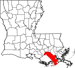 | |
| Towns | ||
| CDPs | ||
| Other communities | ||
| Footnotes | ‡This populated place also has portions in an adjacent parish or parishes | |
This Lafourche Parish, Louisiana state location article is a stub. You can help Wikipedia by adding missing information. |