
Desnoeufs Island
Nickname: Île des Nœufs | |
|---|---|
 Desnœufs Island | |
| Geography | |
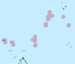
| Location | Indian Ocean |
| Coordinates | 06°14′S 53°32′E / 6.233°S 53.533°E |
| Archipelago | Seychelles |
| Adjacent to | Indian Ocean |
| Total islands | 1 |
| Major islands |
|
| Area | 0.457 km2 (0.176 sq mi) |
| Length | 0.75 km (0.466 mi) |
| Width | 0.7 km (0.43 mi) |
| Coastline | 2.6 km (1.62 mi) |
| Highest elevation | 5.5 m (18 ft) |
| Administration | |
| Group | Outer Islands |
| Sub-Group | Amirante Islands |
| Districts | Outer Islands District |
| Demographics | |
| Population | 0 (2014) |
| Pop. density | 0/km2 (0/sq mi) |
| Ethnic groups | Creole, French, East Africans, Indians. |
| Additional information | |
| Time zone | |
| ISO code | SC-26 |
| Official website | www |
Desnœufs Island is an island in Seychelles, lying at the southern edge of the Amirantes group, in the Outer Islands, with a distance of 321 km south of Victoria, Seychelles.
History
[edit]The origin of the name seems to be its French meaning, "one of nine", as it is one of the nine main islands of the Amirantes.[1]
Geography
[edit]Desnœufs Island is the southernmost island of the Amirantes chain, is a nearly circular island with a high rim surrounding a central depression (instead of a lagoon). It is up to 5.5 m high. Most of the land is exposed sandstone, after the guano has been exploited in the 20th century. The island has a fringing reef, and the reef flat is narrow. Landing can be extremely difficult, with heavy swells sweeping round the island even during the calmest sea conditions.[2][3]
Administration
[edit]The island belongs to Outer Islands District.[4] Being an island with a small population, there are not any government buildings or services. For many services, people have to go to Victoria, which is a difficult task.
Economics
[edit]The occasional villagers of Marie Louise Island used to poach eggs illegally on the island when the island was a base for the commercial exploitation of seabirds, especially the eggs of the sooty tern (Onychoprion fuscatus). recent years the island was made a reservation, and is visited once a year shortly by IDC members and scientists from Mahe. There are ruins on the island from the time of the poaching.
Flora and fauna
[edit]The terrestrial vegetation on the island is limited because of the high number of seabirds. The island is almost treeless and is covered by grasses and other low-growing plants. It has been identified as an Important Bird Area (IBA) by BirdLife International because it supports a breeding population of 430,000 pairs of sooty terns, and a large number of boobies. Green and hawksbill sea turtles also nest there.[5][6] The island is also known for its rich fish life.
Image gallery
[edit]-
 Map 1
Map 1 -
 District Map


References
[edit]- ^ Island history
- ^ "Info on the island". Archived from the original on 2020-11-26. Retrieved 2016-04-06.
- ^ Info on the island 2 Archived April 13, 2016, at the Wayback Machine
- ^ District map
- ^ "Desnoeufs Island". Important Bird Areas factsheet. BirdLife International. 2013. Archived from the original on 2007-07-10. Retrieved 2013-08-17.
- ^ "IDC Site". Archived from the original on 2016-03-19. Retrieved 2016-04-06.
